ADE SaaS: NeMeA Sistemi’s innovative solution for the digitalisation of the municipal cemetery
Improving the efficiency of public services is an inevitable process that is extending into increasingly specific areas, including the digitisation of municipal cemeteries. In this context, NeMeA is at the forefront, presenting the latest development of ADE SaaS.
This solution, developed entirely in a web-based environment using the GeoPortal-X platform, it represents an innovative standard for modern cemetery management, offering practical solutions to local authorities’ organisational needs and introducing new features that benefit both the public and staff.
An integrated platform for digital management
ADE stands out as a SaaS (Software as a Service) system due to its ability to provide integrated and fully digital management of all key aspects of cemetery administration. The software has been designed to be intuitive, minimising the need for technical training and significantly reducing the complexity of day-to-day operations.
The platform enables the structured and secure entry and storage of all information relating to cemetery plots. Each licence can be quickly identified, updated or renewed, with a automatic monitoring of deadlines and the ability to generate the necessary documents immediately. This automated approach improves operational efficiency and reduces the likelihood of errors.
One of the key strengths of the new ADE SaaS is the advanced integration of the management of votive lamps, with an automatic and direct link to each individual niche or grave. This system enables the status of votive candle contracts to be linked, updated and monitored in real time, simplifying the procedures for invoicing and collection of payments. Compatibility with modern payment systems, such as PagoPA, further facilitates its adoption and administrative efficiency.
Detailed cemetery mapping and public services
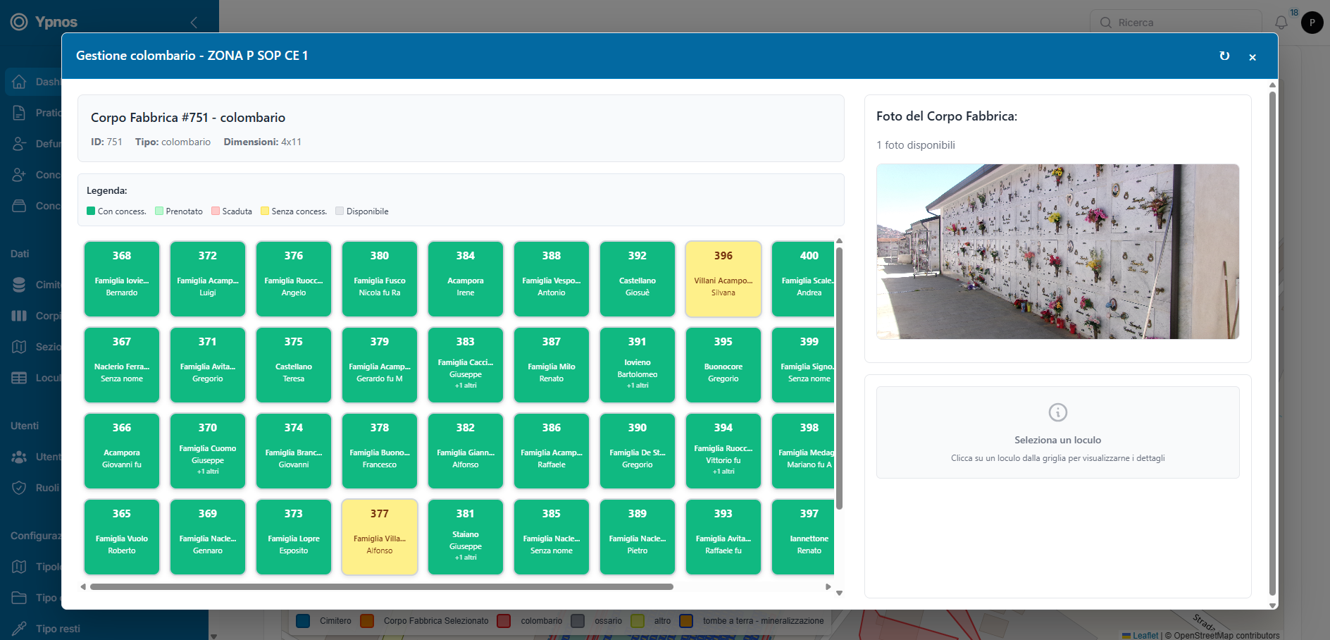
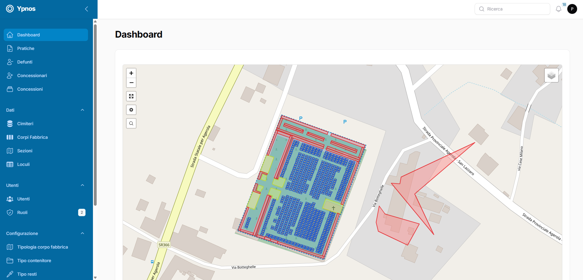
In terms of mapping, ADE SaaS enables the detailed digitisation of the entire municipal cemetery. Each niche, family grave or ground-level grave is geolocated on the map and accompanied by personal details and information on the relevant plots. The plan view and grid display of the blocks provide operators with a clear and immediate overview of the cemetery layout, facilitating operational and administrative tasks such as relocations, renewals, planning of works, and the archiving of documents and photographs.
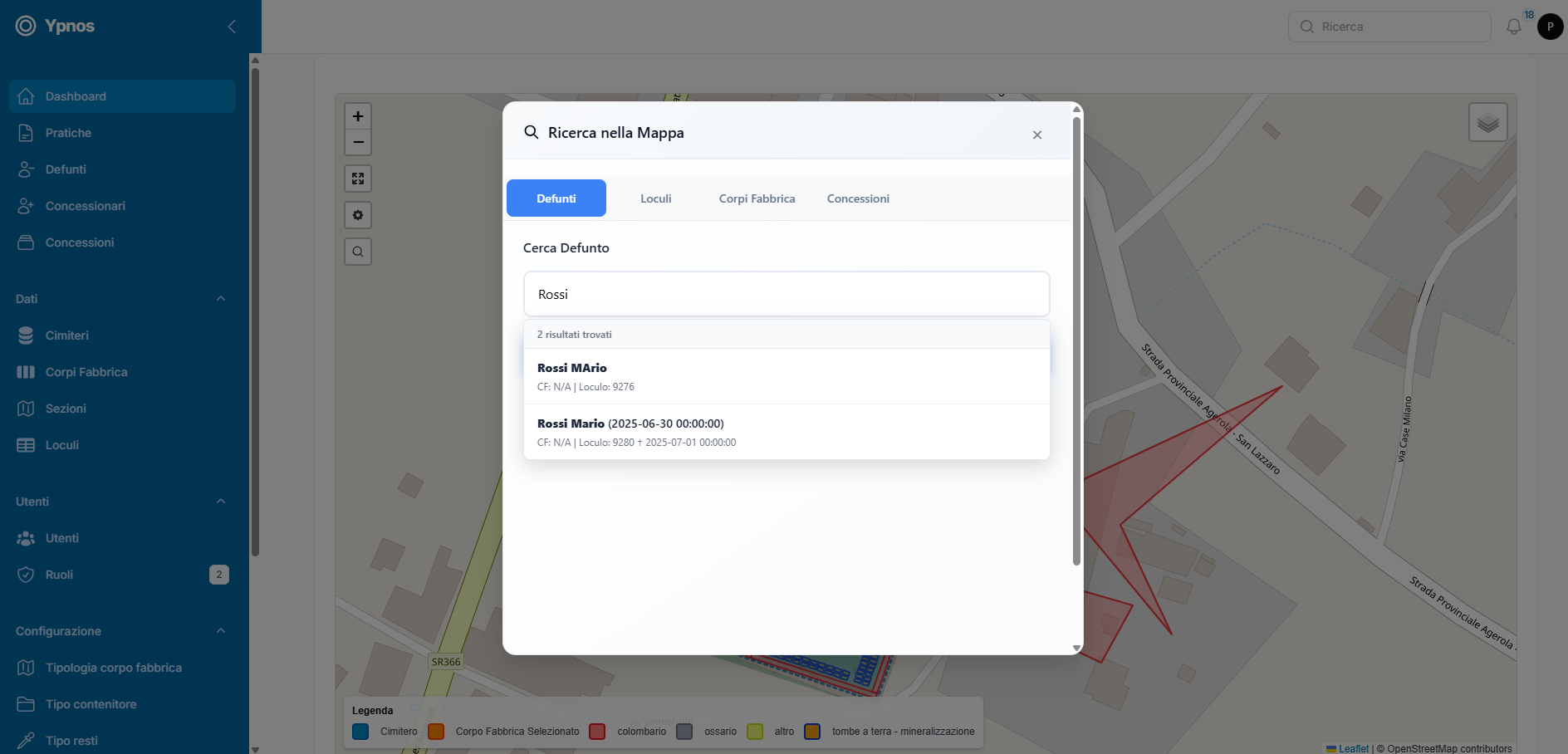
A particularly innovative feature is the public consultation. Thanks to the WebGIS component of GeoPortal-X, members of the public can access a dedicated section where, in compliance with data protection legislation, they can view the location of the deceased on the cemetery map. This service eliminates the traditional difficulties involved in locating graves, ensuring simple and always-available access from any device with a web browser, without the need to install additional software. It represents a significant improvement in the accessibility and transparency of cemetery services for the public.
The cloud-based nature of GeoPortal-X ensures high standards of security, scalability and accessibility, placing the platform amongst the solutions certified in accordance with national cybersecurity regulations and providing assurance of operational continuity even in scenarios involving high demands for data synchronisation and updating.