Services for Marine Protected Areas
Environmental technologies for monitoring and protecting biodiversity
An ecosystem of digital solutions for understanding, monitoring and managing the marine and coastal environment.
NeMeA Sistemi supports the Marine Protected Areas with advanced tools for knowledge of the local area, environmental monitoring and integrated data management. Through advanced GIS platforms, through observation systems and dedicated digital technologies, we help to build up an up-to-date body of information that is useful for analysing environmental phenomena, identifying critical issues and guiding planning and conservation activities.
Thanks to an interoperable approach, data from various sources are collected, organised and made immediately accessible within a single technology ecosystem. In this way, the data does not remain fragmented, but is transformed into a practical tool to support decision-making and the enhancement of our natural heritage.
GeoPortal-X
GeoPortal-X it is the cloud-based WebGIS platform developed by NeMeA for collect, organise, consult and analyse geospatial data in a simple, fast and customisable way. For Marine Protected Areas, it represents the centrepiece of the entire digital ecosystem: the common thread that links different technologies, devices, surveys and observation systems, transforming data from diverse sources into a single, organised and immediately accessible information resource. In this way, all NeMeA solutions find in GeoPortal-X the common environment in which data is made accessible, readable and useful for supporting monitoring, planning and action.
Coastline monitoring
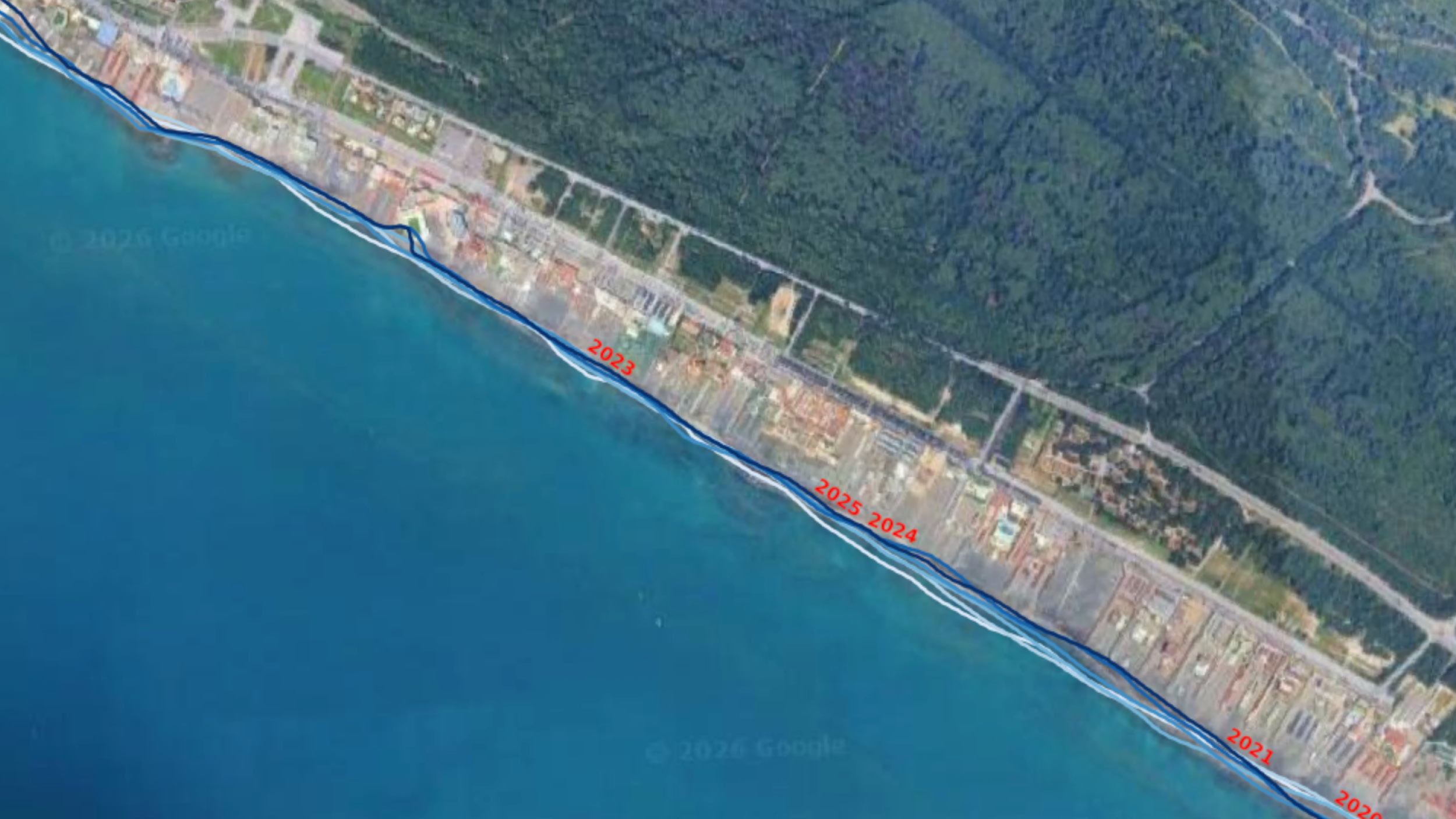
NeMeA provides a system dedicated to theanalysis and monitoring of the coastline, designed to monitor changes to the coastline over time and identify critical issues such as erosion, flooding or land subsidence. The approach integrates multi-source and multi-scale data, satellite observations, sensors and field surveys, providing immediate operational information.
Protection of Posidonia oceanica
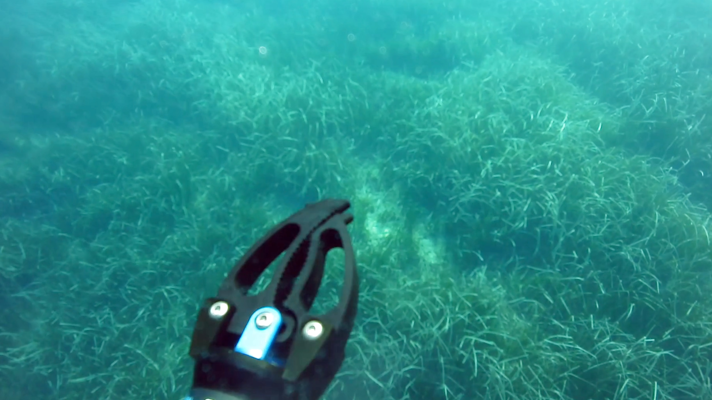
The conservation of Posidonia oceanica It is a key component of environmental protection activities within MPAs. NeMeA supports this area through an integrated approach that combines field surveys, sensor technology, geospatial analysis and advanced digital tools, which are useful for mapping of the Posidonia habitat and to understanding the changes taking place along the coastline.
Earth Observation from Space
Through 3xA®, NeMeA transforms the satellite data into useful information for environmental monitoring, by integrating RADAR/SAR imagery, hyper- and multispectral optical data, deep learning algorithms and cloud-based neural networks. This service enables to analyse the relationship between the sea, the coast and the land, to detect changes over time and to support the protection of habitats, water quality and marine biodiversity.
Land and marine surveys
I reliefs are an essential tool for to collect accurate, reliable and immediately usable data in the GIS and WebGIS systems. Using mobile GIS equipment and field surveys, NeMeA generates geodata that is useful for understanding the environmental context, planning interventions and the operational management of protected areas.
Digital Twin
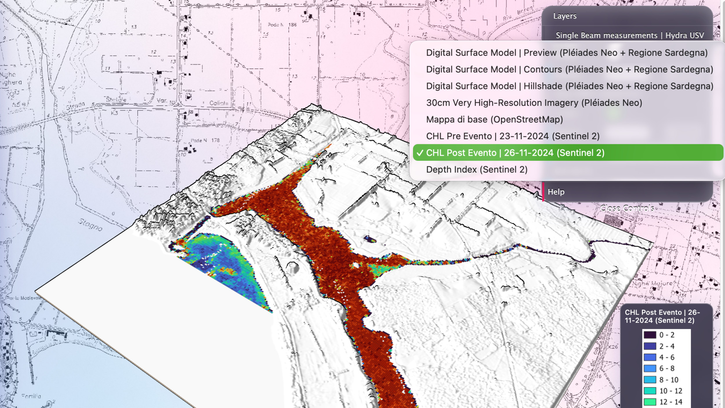
The Digital Twin enables environmental data to be transformed into a a dynamic analysis of the marine and coastal ecosystem. By integrating information from various sources into a single digital environment smart buoys, sensors, surveys and satellite data, this solution supports the dynamic analysis of phenomena, the early identification of critical issues and the simulation of scenarios useful for prevention and planning.
HYDRA®
HYDRA® it is the surface aquatic drone developed by NeMeA for surveying and monitoring of the coastal zone. Thanks to high-precision GNSS, advanced sonar, an HD underwater camera and a scalable multi-sensor approach, it enables the performance of bathymetric surveys and monitoring of the inner coastal zone reliably, quickly and consistently.
ROV
The ROV supports the activities of underwater inspection and on-site observation of submerged ecosystems. Through detailed video recordings, sampling and direct observation of the seabed, helps the AMPs to monitor the conservation status of sensitive habitats, investigate phenomena detected by other systems and strengthen their capacity for gathering information and making decisions in the field.
IoT buoys
The IoT buoys are autonomous environmental monitoring stations designed for the continuous monitoring of sea parameters. They enable the in situ measurement of key data such as temperature, salinity, pH and dissolved oxygen, transmitting this information to the NeMeA digital platforms for constant, timely and action-oriented monitoring.
Multiparameter probes
The multi-parameter probes are an essential safeguard for the continuous monitoring of water quality. Employed in marine, lake and river environments, enable the monitoring of parameters such as temperature, conductivity, pH, dissolved oxygen, turbidity and salinity, helping to establish a connected, distributed monitoring system that aids in prevention.
Dashboard
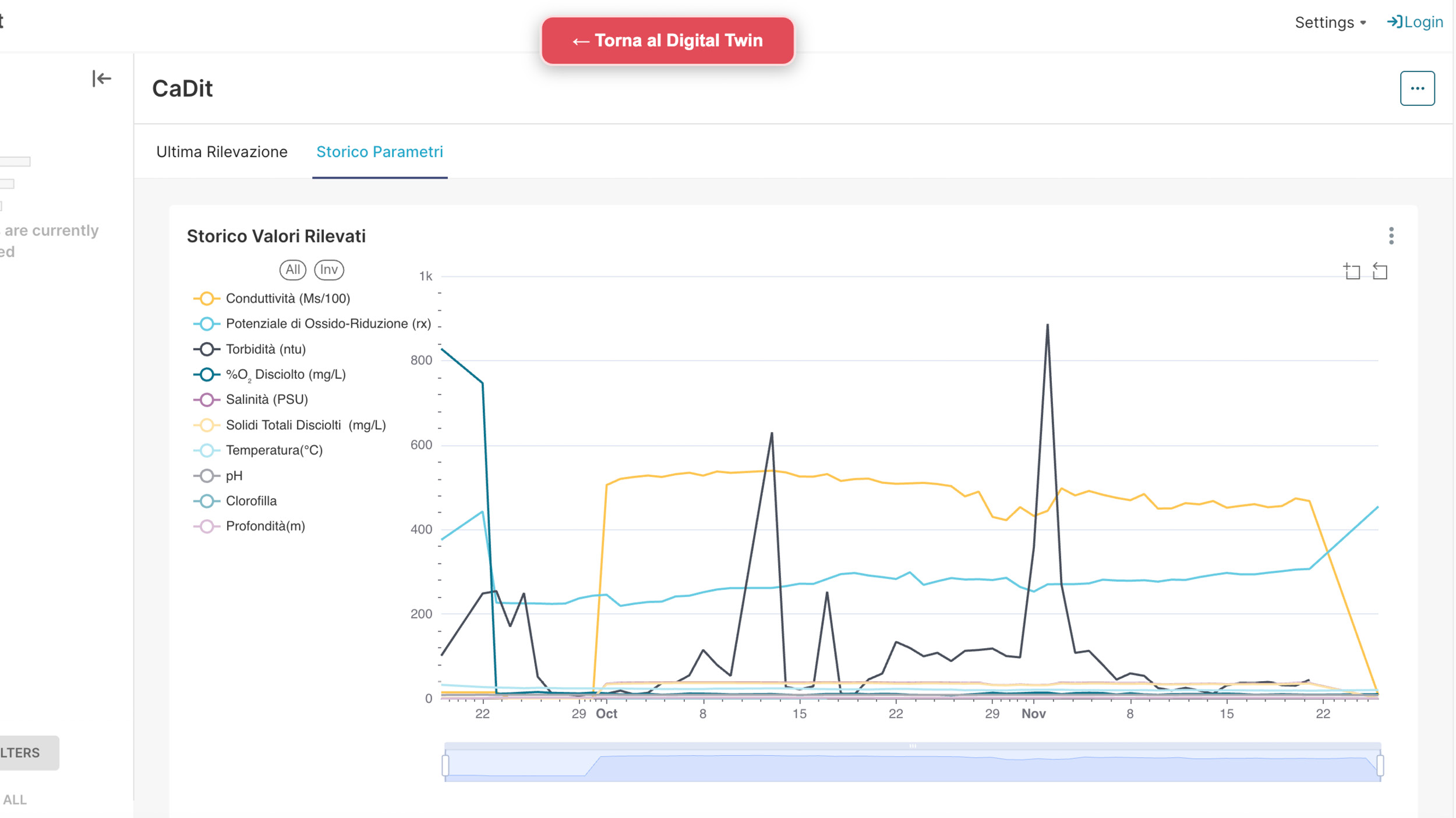
The dashboard They form the integrated environment in which data is organised, interpreted and made immediately accessible. Time series, summary indicators, visual analytics and threshold rules enable operators to monitor thetrends in phenomena, identifying anomalies and to have a practical tool for decision support.
XMapp
XMapp it is themobile app developed by NeMeA for the dissemination of institutional information, geolocated content, news, events and local services. The solution enables you to centralise the publication of content and distribute them across the organisation’s various digital channels, thereby improving the timeliness and consistency of information and the organisation’s ability to communicate with citizens and visitors.
VideoStream
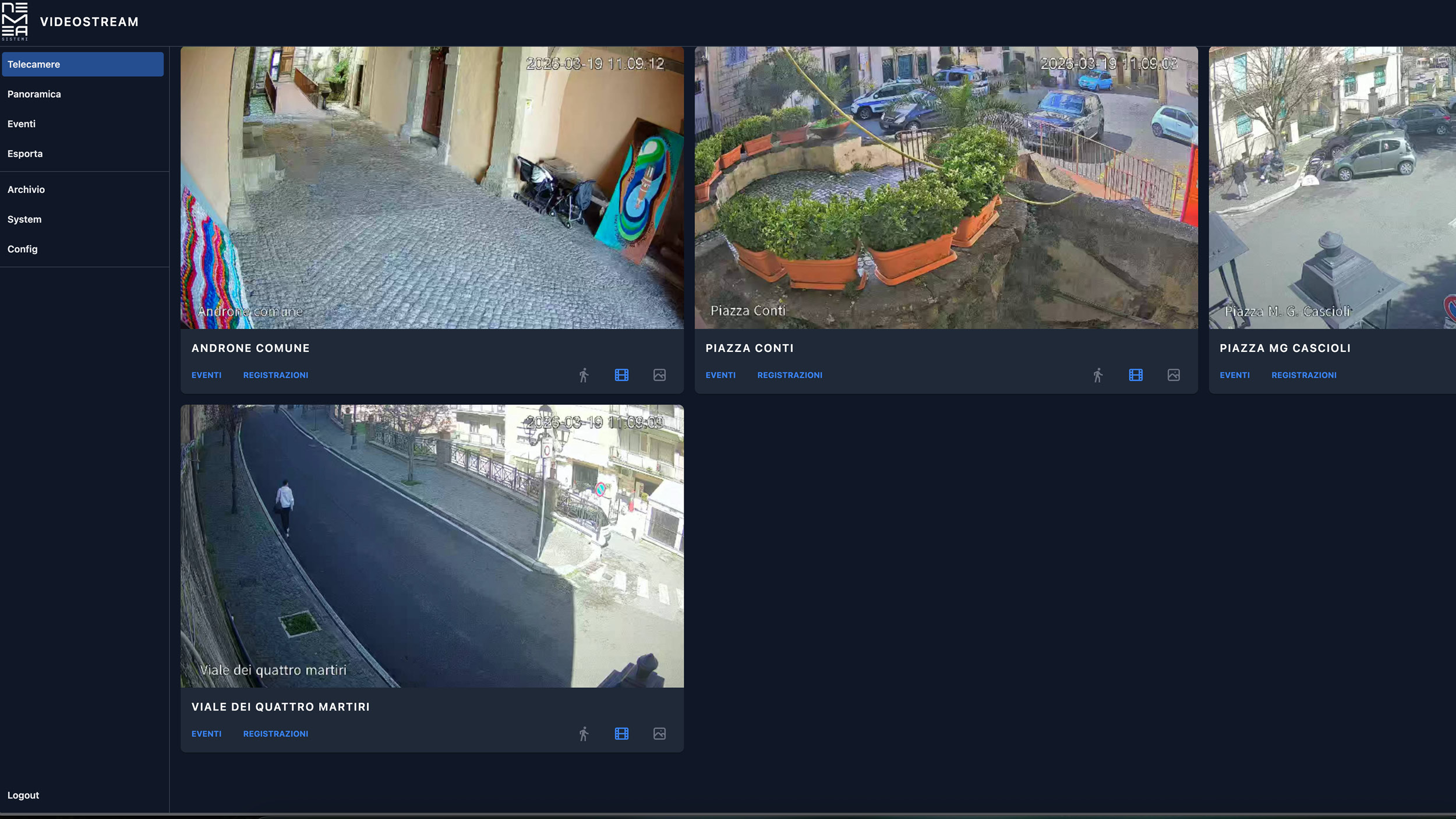
VideoStream it is the cloud-based video surveillance platform comprehensive coverage of the area. The system allows users to view live video feeds, manage recordings, search for archived footage and export content, thereby enhancing the ability to monitoring and safeguarding of sensitive areas as part of a more coordinated approach to managing the environmental and operational context.
Websites and social media
NeMeA also supports the AMPs in the digital communication, via dedicated websites, social media channels and information resources designed to promote the local area and raise awareness amongst residents and visitors. The aim is to translate geoinformation into clear, accessible and user-friendly content, which are capable of raising public awareness of biodiversity and encouraging its conservation.
3D printing
The 3D printing It represents a practical driver of innovation for making environmental monitoring systems more efficient, sustainable and replicable. When applied to the manufacture of components for observation and control devices, such as data buoys, enables you to reduce costs and development time, to streamline the design process and enhance the scalability of solutions.
Contact us
Send an email to INFO@NEMEASISTEMI.COM or fill in the form by clicking here.
Sign up for our newsletter
NeMeA Sistemi We are delighted to offer this additional service to everyone – customers and non-customers alike – designed to keep you up to date with the latest news regarding our Research and Development (R&D) projects, our services and new applications.